MOMOMS focuses on the development of tools and methods dedicated to increase the resolution of satellite-derived SSH datasets and subsequent products.
For several years and still today, SSH maps have been produced from altimetric data delivered by constellations of 3 or 4 nadir-looking altimeters. For this reason essentially, SSH datasets do not resolve wavelengths shorter than 200 km. However, the present-day challenges related to climate and halieutic resources call for higher-resolution SSH datasets. Acknowledging that the number of nadir-looking altimeters is not expected to drastically increase in the near future, two complementary strategies can be considered to reach this goal: Using high-resolution models to desegregate and “fill the gaps” of the data, or introducing new, high-resolution observations in the production process.
This project covers both strategies, and adresses the challenge of merging ocean models and observations of different types and at different scales to support altimetry in the production of maps of SSH and derivative products such as surface currents. It is decomposed into 4 axes:
- Development of high resolution data assimilation systems (models, representation of uncertainties, etc);
- Observability of fine mesoscale dynamics by altimetry;
- New, multi-scale algorithms for data inversion and assimilation;
- Multi-sensor based ocean reconstruction.
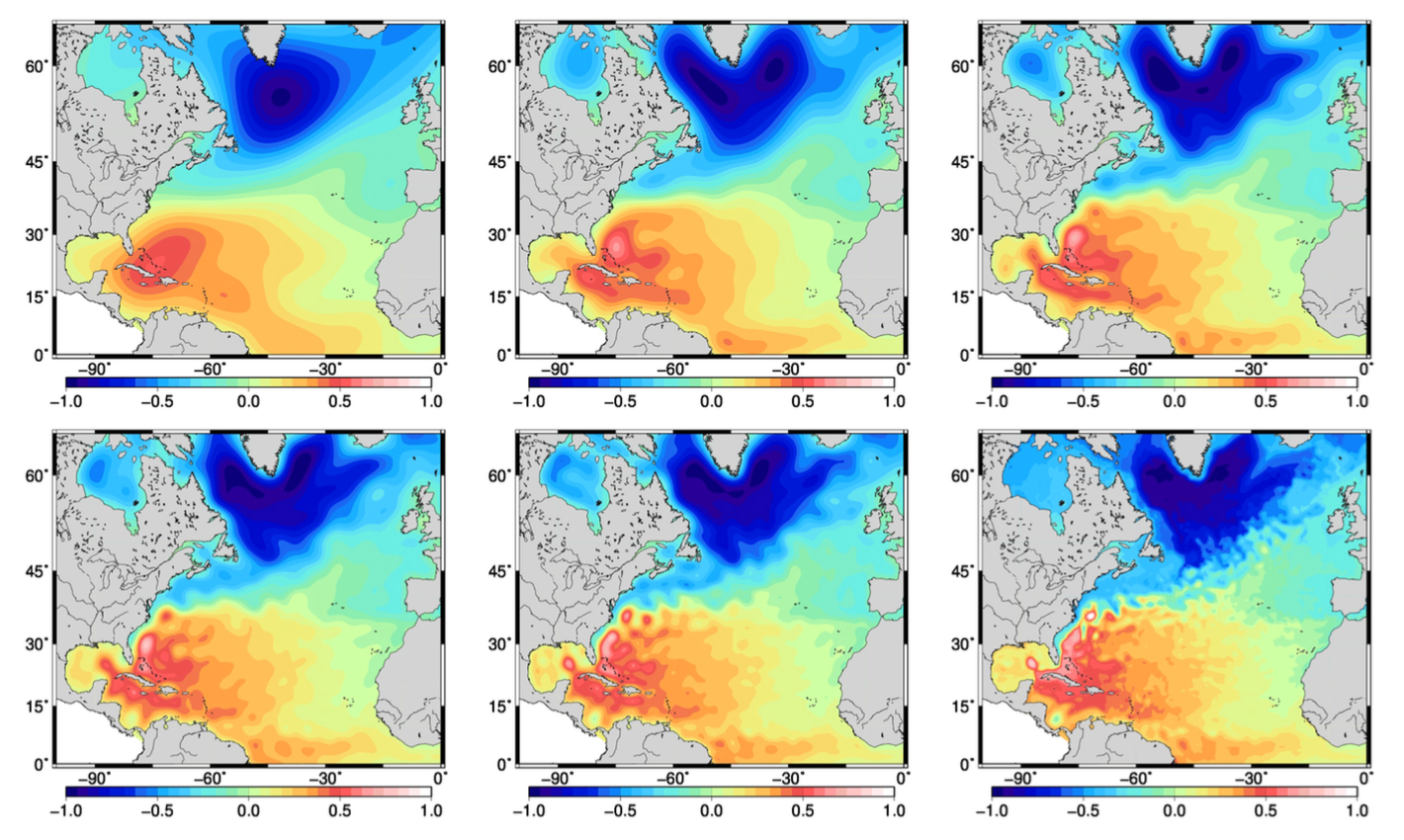
Figure 1 : Sea Surface Height fields represented by NEMO ocean circulation model at different scales. Like models, satellite and in situ observations may represent different scales of the ocean circulation. All types of observations, along with models, are needed to portray the full ocean circulation, because all these scales are in constant dynamical interaction.
MOMOMS project is funded by CNES as part of the Ocean Surface Topography Science Team (OSTST) project.