The Surface Water and Ocean Topography mission will provide observations of sea surface height and surface roughness at scales <100 km, therefore opening the way for the systematic study of ocean turbulence down to the sub-mesoscales. The mission is in particular expected to yield a breakthrough in our understanding of energy pathways toward small scales in the global ocean and of the vertical exchanges between the surface layers and the ocean interior.
Reaching the above mission objectives depends on our ability to reliably estimate surface currents and their lateral gradients at small scale from sea surface height and roughness observations. Because of the nature of SWOT errors and sampling, this estimation will essentially rely on inversion methods. These methods include several data-oriented approaches and also approaches based on comprehensive 3D ocean circulation models with data-assimilation. SWOT data simulated from realistic circulation models are key for designing and evaluating the above inversion methods. But the wide range of dynamical regimes at scales <100km is still imperfectly documented and realistic basin-scale to sub-mesoscale resolving models are just emerging. It is also unclear what is the optimal data-assimilation strategy for inverting SWOT observations.

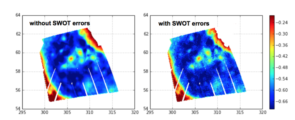
Figure 1 : Simulated SWOT SSH data [m] over a 5 days window in the Labrador sea. Data produced with our 1/60° North Atlantic model NEMO model configuration using the SWOT simulator (JPL/NASA). left panel : without SWOT error; right panel : with SWOT errors. Most of the spatially uncorrelated noise is associated with KaRin instrument noise.
Our contribution to SWOT Science Team aims at studying (i) the information that future SWOT ocean data will hold in terms of surface dynamics and (ii) how this information can be retrieved with inversion methods. Our group is in particular in charge of providing simulated SWOT data over the North Atlantic to the science team (learn morehttps://github.com/ocean-next/eNATL60).